Sustaining Beauty of the <<land of low- laying cloud>>

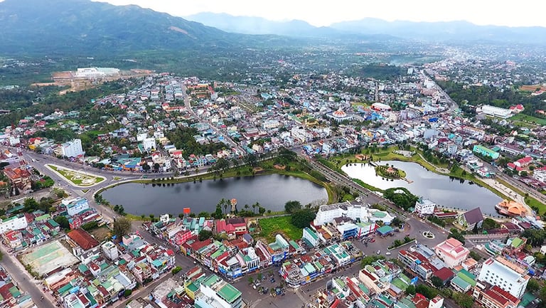
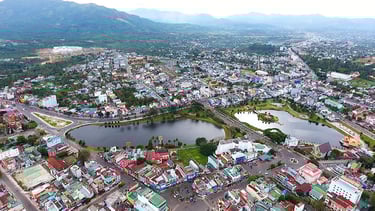
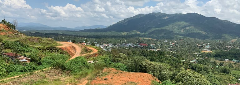
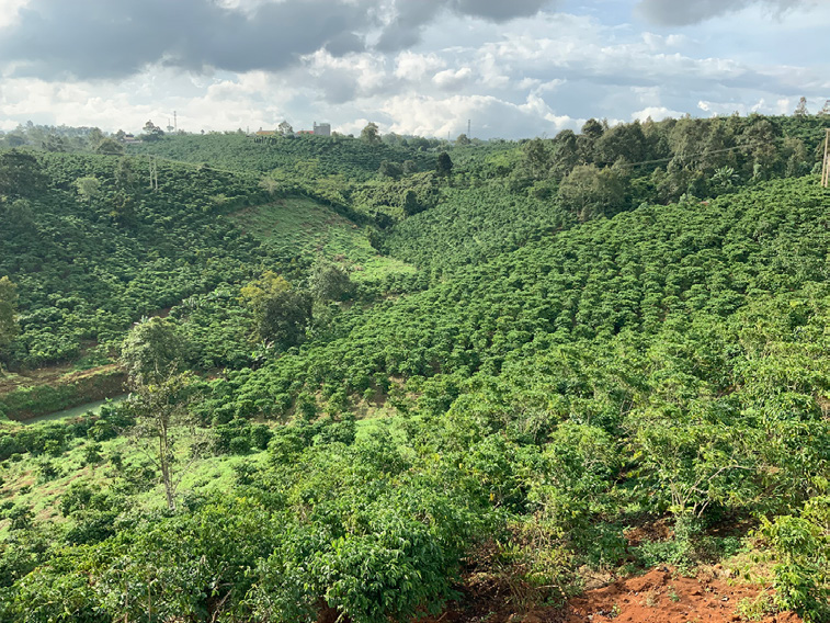
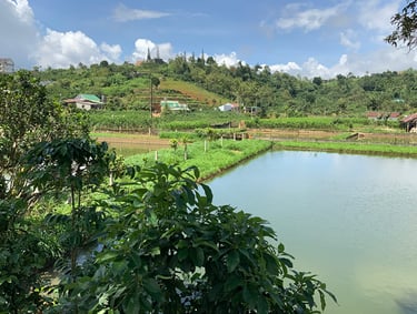
“Bao Loc (meaning “land of low-flying cloud” for the Ma people and “good” for the Khor) is the unblemished jewel of the South Central Highlands. It has not suffered the exploitative curse that has besieged Dalat – now overrun with large tourist resorts, golf courses and a sea of plastic greenhouses that irreversibly destroy the qualities of the landscape that constituted its attraction. Bao Loc must be very careful to not fall into the short-lived consumerist development-driven trap that undermines its heritage and natural beauty and instead set out a productive development path that anchors itself on and strengthens the unique qualities of the landscape, which is its main and irreplaceable asset. It must harness all of it resources to raise a majority of the population from poverty and create new context-responsive economies. Bao Loc city and surrounding villages are settled within a majestic landscape marked by strong mountain ranges (north, west and south), large solitary mountains (such as Dai Binh), a system of man-made chains of ponds and valleys (to the north and with mulberry and agriculture) and innumerable hillocks (to the south and northwest with tea and coffee). In the middle of this accentuated landscape lies the enormous Di Linh plateau, where the city has developed.” (Shannon and De Meulder 2020).
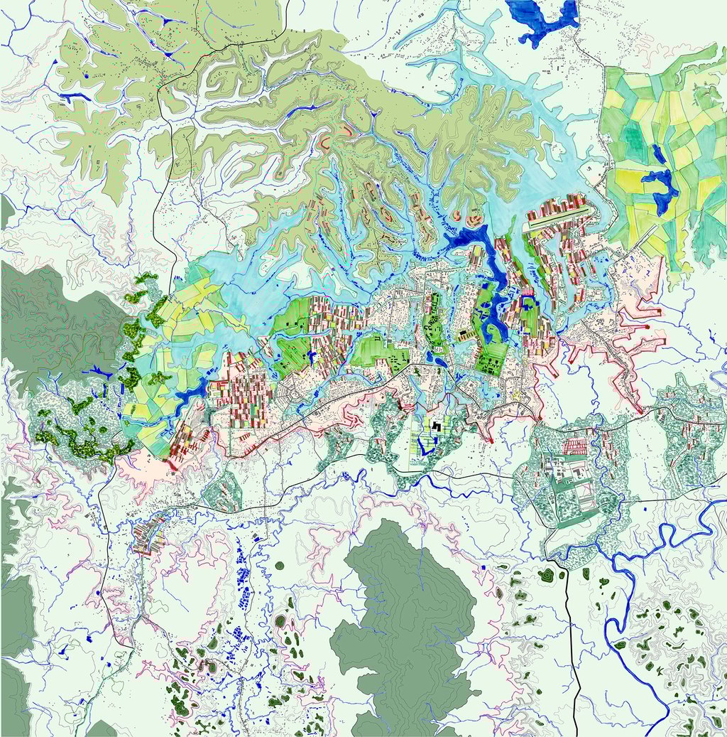
The design is to find the way to move forward intelligently which is using the strengths of topography and landscape (especially forest and water) to create a framework for structuring the urban development of Bao Loc till 2040.
Location: Bao Loc, Vietnam
Designers: RUA (Kelly Shannon, Bruno De Meulder, Minh Quang Nguyen)+ Vietnam Urban & Rural Planning Institute (VIUP)
International competition 2020: General planning ideas of Bao Loc city and surrounding areas till 2040. (Lam Dong Province, Vietnam)
Award: 3rd Prize
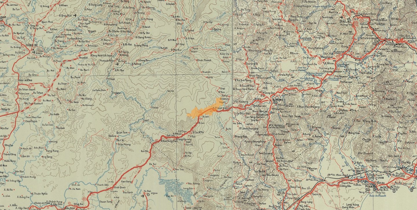
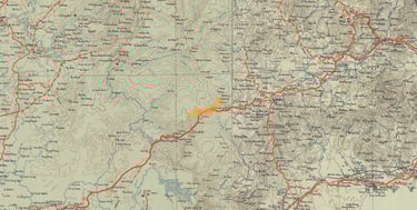
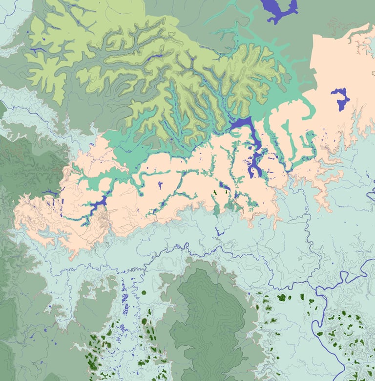
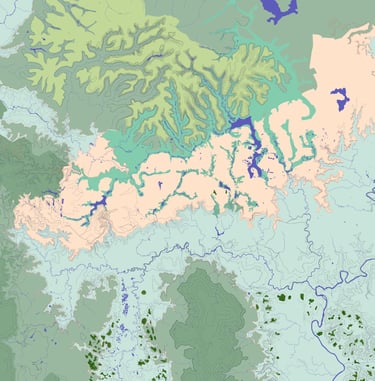
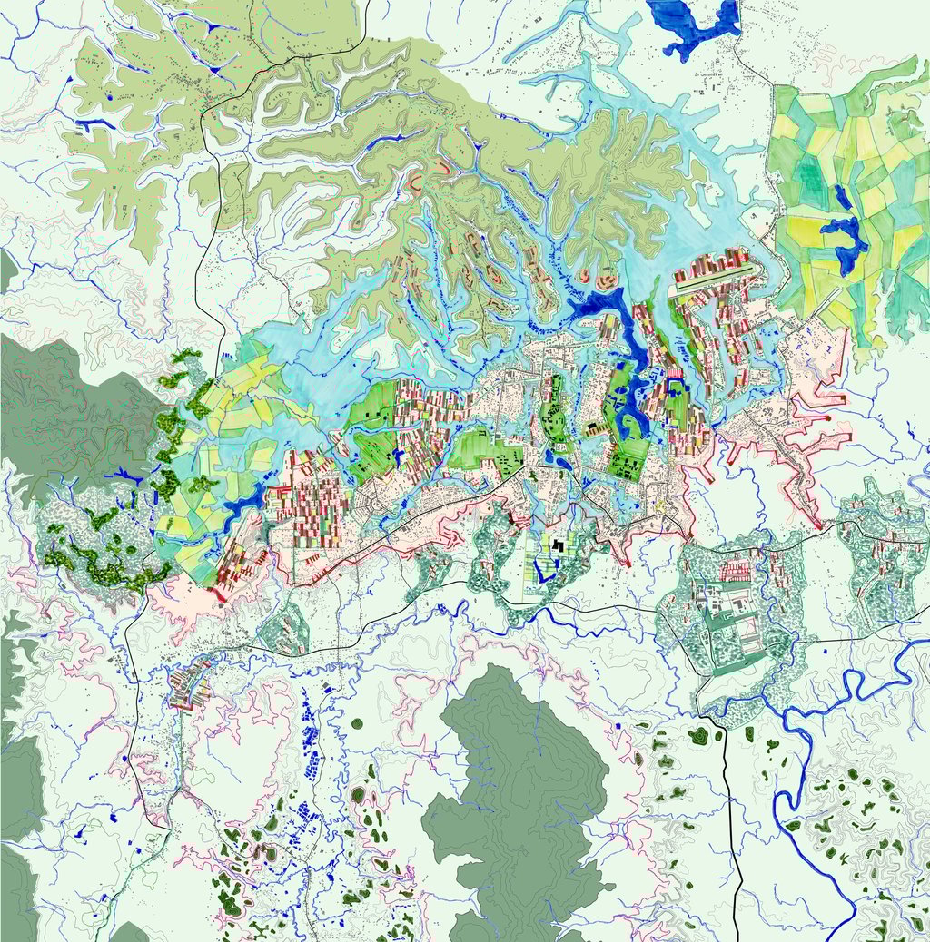
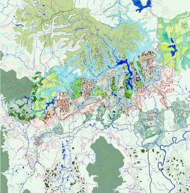
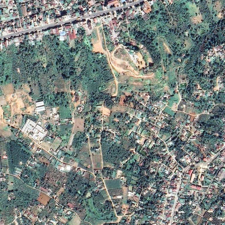
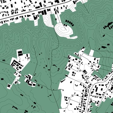
1945 topographic map of South Central Highlands: Di Linh Plateau is evident. It is roughly 1614,63 square km and demarcated on its south side by a sharp rupture in topography.


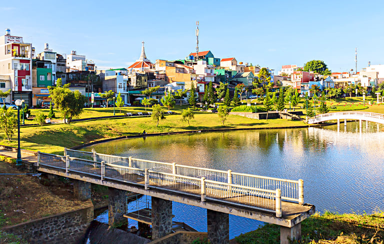
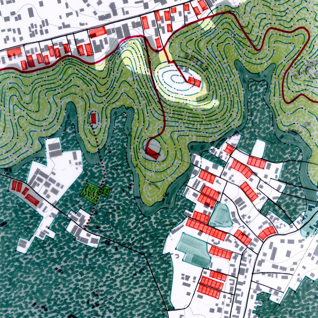
Bao Loc lake
coffee / tea / mulberry
valley pond / farms
city lake front
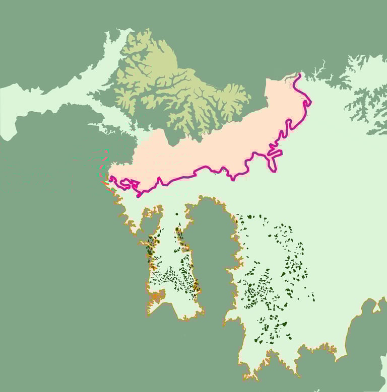
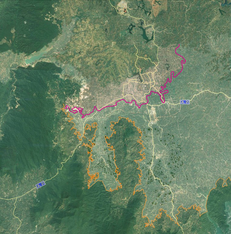

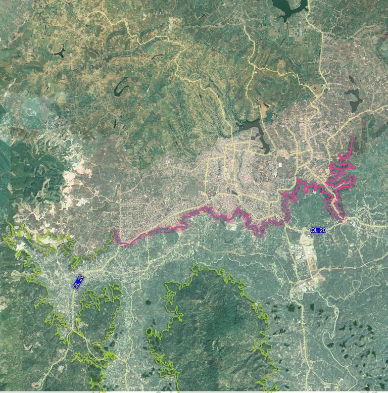
Topographic interpretation with steep altitude/ fault line (pink at 850-700 m and parallel to the city structure) becomes a belvedere (city balcony) overlooking the magnificent landscape to the south. A northern path system (orange, also at 850-700 m) becomes a park path system.

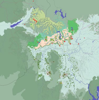
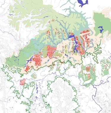
Existing & proposed points of interest in greater Bao Loc (tourism, recreation, etc.)

Existing landscape: strong figures defined by topography

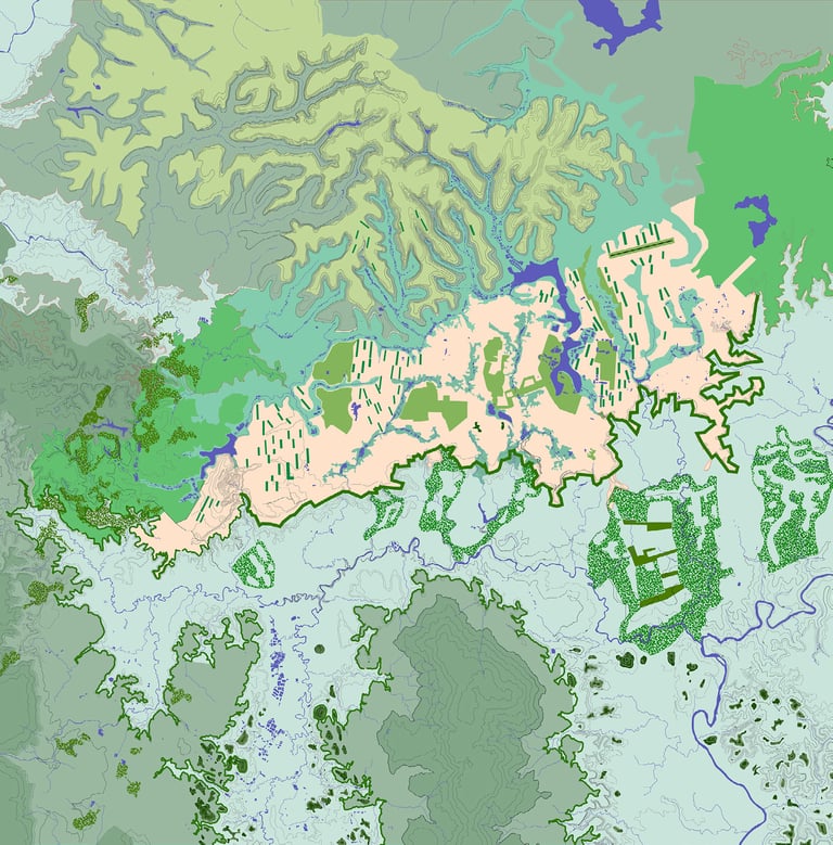
Accentuation of landacpes: forceful blue and green frame
New urban development: densification guided by landscape


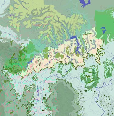
Intelligently moving Bao loc towards 2040
Step Slope Belvedere
> south edge of the Di Linh plateau is defined by a steep slope (800 to 775 meters).
> unique possibility to create a long linear belvedere park front as a sequence of city balconies.
> seen from the south, the belvedere park front acts as a plinth in the landscape
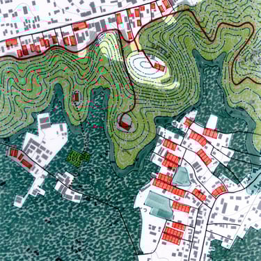
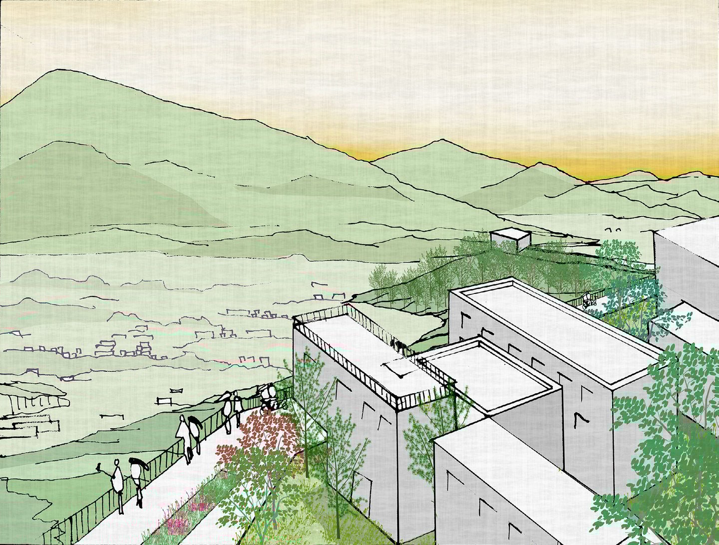

BELVEDERE: near 30km park front with spectacular south-facing views.
spectacular panoramas
Topographic interpretation with steep altitude/ fault line (pink at 850-700 m and parallel to the city structure) becomes a belvedere (city balcony) overlooking the magnificent landscape to the south. A northern path system (orange, also at 850-700 m) becomes a park path system.
Related Stories
Please feel free to contact us if you need any further information. We look forward to a successful working relationship in the future.